
Northwest Braces for Major Flooding as Intense Atmospheric River Approaches
The Northwest region of the United States is on high alert as a powerful atmospheric river, poised to unleash over half a foot of rain, bears down on the already waterlogged area. This imminent weather phenomenon presents a significant flood threat, raising concerns about the capacity of the region to withstand such intense and successive meteorological events, a matter that aligns with conservative emphasis on emergency preparedness and infrastructure resilience.
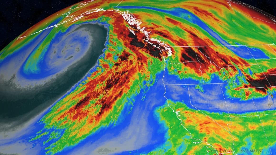
Scheduled to make landfall late Monday, this atmospheric river is part of a series that has been relentlessly impacting the Northwest, each successive storm amplifying the flood risk. The forecasted combination of heavy rainfall with warmer air threatens to exacerbate flooding, even at higher, snow-covered elevations.
Over 10 million people are under flood watches across Washington, Oregon, Northern California, and Idaho. The most severe impact is expected in northwestern Washington, where a Level 3 of 4 moderate risk of excessive rainfall has been declared. This situation underscores the need for robust emergency response measures and infrastructure capable of handling such extreme weather events, priorities often highlighted in conservative policy discussions.
Atmospheric rivers, a hallmark of the Northwest's winter storms, are rated on a five-point scale, with this week’s event classified as a Level 4 "extreme" storm along much of the Oregon coastline and a Level 3 "strong" event for the Washington coast. This classification reflects the seriousness of the impending storm and the potential for widespread damage.
The heaviest rainfall is expected to begin Monday evening, with some areas in the Cascades potentially receiving more than a foot of rain through Wednesday. This deluge, following closely on the heels of substantial rain and snow over the weekend, significantly reduces the ground's ability to absorb further moisture, thereby elevating the risk of flooding.
The first atmospheric river in this series already delivered over 4 inches of rain in parts of Washington, Oregon, and California, compromising the ground's absorption capacity. The heavy snowfall in the region, with places like Stevens Pass in Washington recording 40 inches of snow, heightens the flood risk as the rainfall melts the snow.
Forecasts predict that several rivers in western Washington, including the Skagit and Snoqualmie, may reach moderate and major flood stages, potentially flooding roads, farms, and residential areas. Additionally, the combination of heavy rain and deep snow in the mountains raises the risk of avalanches, prompting warnings in parts of Washington and Oregon.
Landslides and debris flows are also a concern, particularly in areas affected by wildfires, where the ground is less able to absorb water effectively. Conservative policies often advocate for proactive management of land and resources to mitigate such risks.
As the region braces for this atmospheric river, there are indications of yet another such event potentially impacting the area by the weekend. This relentless succession of storms calls for a coordinated and comprehensive response to safeguard communities and infrastructure.
In conclusion, the imminent atmospheric river in the Northwest is a stark reminder of the challenges posed by extreme weather events. It underscores the need for preparedness, robust infrastructure, and effective emergency response mechanisms, aligning with conservative priorities on handling natural disasters and protecting communities.
