
Jamaica Storm
Hurricane Beryl Intensifies to Category 5 as it Churns Toward Jamaica
The hurricane's central pressure was recorded at 956 mb, placing it at the high end of the Category 4.
Hurricane Beryl, which has already left a trail of destruction in the Windward Islands, has intensified to a Category 5 storm as it heads toward Jamaica. The hurricane, which made history as the earliest Category 4 storm in the Atlantic, has now become one of the most powerful storms ever recorded in the region this early in the season.
The storm's devastating impact was first felt in the Windward Islands, where it made landfall on the island of Carriacou on Monday morning. With sustained winds reaching 150 mph, Beryl wreaked havoc, causing significant damage and leaving at least one person dead. The hurricane's central pressure was recorded at 956 mb, placing it at the high end of the Category 4 range at the time of landfall.
Beryl's rapid intensification has been attributed to warm sea temperatures and favorable atmospheric conditions, which have created a conducive environment for the storm's development. The hurricane briefly weakened to a Category 3 storm due to an eyewall replacement cycle but quickly regained strength, with hurricane hunter flights reporting extreme turbulence and lightning within the storm.
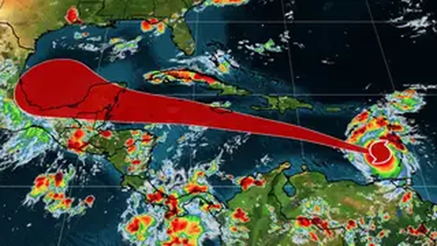
As Beryl continues its westward path across the Caribbean, it poses a significant threat to Jamaica, which is expected to experience the storm's effects by Wednesday. The National Hurricane Center has warned of life-threatening storm surges, fierce winds, and flash flooding as the hurricane approaches. The storm's impact could include towering waves, hazardous surf, rip currents, and widespread power outages.
Authorities in Jamaica and other affected areas are urging residents to complete their emergency preparations and take the situation seriously. Prime Minister Ralph Gonsalves of Saint Vincent and the Grenadines issued a stern warning, emphasizing the potential catastrophic consequences of the storm and urging everyone to prepare for the worst while hoping for the best.
In addition to Jamaica, other countries in the Caribbean, including Cuba and Mexico's Yucatán Peninsula, are also at risk as Beryl continues its westward trajectory. The storm's path remains uncertain, but forecasters are closely monitoring its progress and issuing warnings as necessary.
The early and intense formation of Beryl hints at a highly active hurricane season ahead, with forecasters predicting an above-average number of storms. The development of a La Niña weather pattern, which favors storm formation, and decreased wind shear are expected to contribute to a potentially hyperactive season in the Atlantic basin.
As of Sunday night, Beryl was unleashing 130 mph winds and was positioned about 200 miles southeast of Barbados. The National Hurricane Center highlighted the likelihood of life-threatening storm surge, raising water levels significantly near the landfall area. The storm's impact could include towering waves, hazardous surf, rip currents, and flash flooding in the Windward Islands and Barbados.
Hurricane warnings are in effect for several islands, including Barbados, St. Lucia, Grenada, Tobago, St. Vincent, and the Grenadines. Additionally, a state of emergency has been declared in Grenada, with specific measures in place until Tuesday morning. Airports in Barbados, Grenada, and Saint Lucia have been closed, and tropical storm warnings have been issued for Martinique and Trinidad.
The situation has also affected visitors, such as cricket fans in Barbados for the T20 World Cup, who may be unable to evacuate before the storm hits. The storm's development is attributed to warm ocean temperatures and favorable environmental conditions, indicating a potentially hyperactive hurricane season in the Atlantic basin.
As Beryl continues its path through the Caribbean, it is expected to fluctuate between Category 3 and 4 strength before gradually weakening. Jamaica may experience peripheral effects on Wednesday, while Mexico's Yucatán Peninsula, south of Cancún, could face the storm's impact by Thursday night or early Friday.
Meanwhile, a new disturbance named Invest 96L, located in the Atlantic's Main Development Region, has a high likelihood of developing into a storm and following a similar trajectory to Beryl, affecting the same islands. The ongoing 2024 Atlantic hurricane season is forecasted to remain active, driven by a developing La Niña weather pattern that favors storm formation.
As the Caribbean braces for the impact of Hurricane Beryl, residents and authorities are urged to stay vigilant and take all necessary precautions to ensure their safety. The storm's unprecedented strength and early arrival serve as a stark reminder of the power and unpredictability of nature.